It seems that there was also a third TACAN site in Laos in the 1960s. Anyone knows where exactly and on which TACAN channel it operated?
 
We used to supply a site near PS 45 that we called channel 82 that was on a mountain top south of Pakse overlooking south central Laos. Channel 82 was listed as being at Pakse so I'm not sure it was a TACAN site or a listening post but we would carry technicians there to work on equipment. The mountain top was cloud covered most of the time making it difficult to get into. We also supported Channel 99 at Mukdahan Thailand
 
Thanks for sharing your experiences. Ch 82 would be an absolute novelty. Are you absolutely sure that the site operated on ch 82 provided that it was a TACAN?

It seems that there was a TACAN site in central/south Laos at 1610N/10621E, but it operated on ch 72. I am not sure if it could have been the LS-44 'Paula' at Ban Khot, Saravane (Salavan), emplaced April 1966.
 
Don't know channel number if it was a TACAN station (48PWB8647 MGRS 105.7995374E 14.8962039N) We had to stay with the technicians because of what had happen at LS 85 and LS 61A which typically was a few hours. I think other supplies came in by RLAF or Air America
 

Attachments

  • 2097_1.gif
    2097_1.gif
    10.3 MB · Views: 32
  • 2096_1.gif
    2096_1.gif
    11.6 MB · Views: 29
Here is a map of the Lima/Papa sites in Google Earth - accuracy is about 1/2 mile. You need to remove the .txt extension because it is a KML file which this app will not allow for upload. Then open it in Google Earth
 

Attachments

  • all_lima_sites.kml.txt
    124.1 KB · Views: 13
Last edited:
Don't know channel number if it was a TACAN station (48PWB8647 MGRS 105.7995374E 14.8962039N) We had to stay with the technicians because of what had happen at LS 85 and LS 61A which typically was a few hours. I think other supplies came in by RLAF or Air America

Great information! Thank you for sharing. If the helo was pictured at 105.7995374E; 14.8962039N, then, given the antennas visible in the background, the site looked like a commo station or a radio relay. I couldn't spot a TACAN antenna. Google maps' satellite photo of that site is unfortunately obscured by clouds. It would be interesting to verify what was left from the war time out there.

The file with the list of LS/PS sites mentioned TACAN only at Vientiane (operating on ch 68) but with coarse location. I assume it was installed within the Wattay airports just north of the pin.

We know there were more TACAN stations in Laos in the 1960s apart from LS-85 and LS-61. Finding their locations would contribute to better understanding of challenges and constraints in USAF jets' navigation routes from Thailand to NVN in the 1960s.
 
Water delivery channel 99 at Mukdahan Thailand fall of 1972. Good view of antennas
 

Attachments

  • 8020_1.gif
    8020_1.gif
    12.7 MB · Views: 25
  • 8008_1.gif
    8008_1.gif
    11.2 MB · Views: 37
Last edited:
This may help - found it online

I was at the 74th Comm Group (7/13AF Pacaf Hat). I was responsible for supporting Gene R and Col Tyrell at Vientien, Laos. I also, directly supported, the CIA when they had any special project. The Pakse facility was run by a CIA fellow from Louisiana. Most of the CIA FOLKS went only by a first name. I may have his name somewhere in some files that are stored.

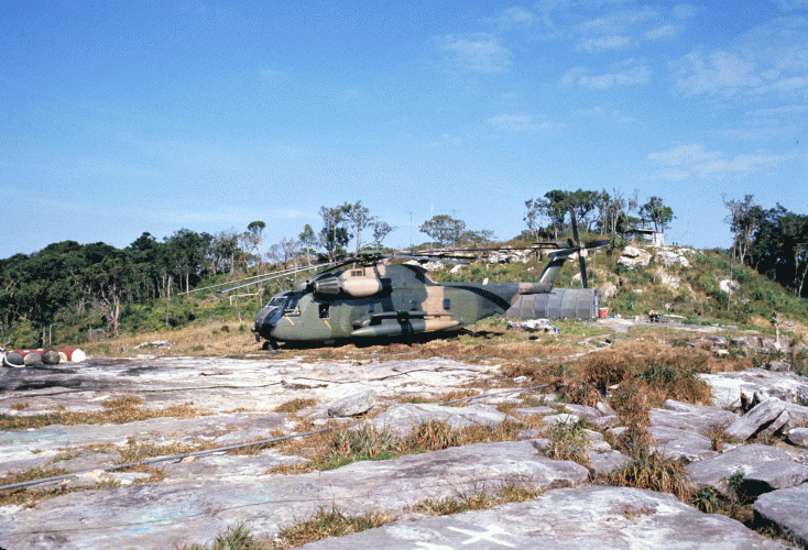
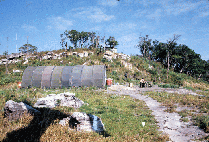
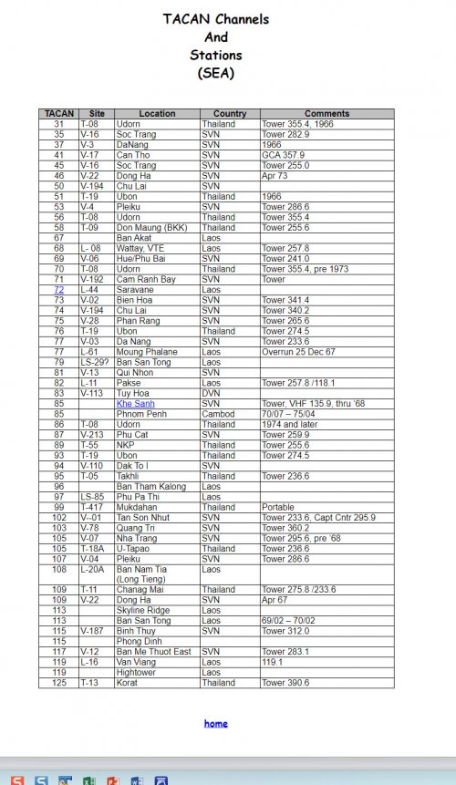
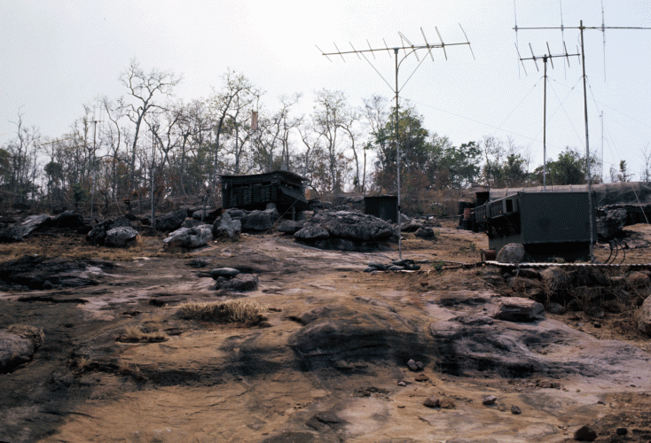
Pakse was our support facility for the TACAN site Channel 72. It was the closest support facility site to the TACAN. We had two Philipinos who fueled the generator for the TACAN facility. We provided them with an HF radio for any emergency situation. Without my notes I cannot give you specific dates of "when" things happened to Channel 72 but I can tell you the details of what happened to it.

One day it just went off the air. This meant that (1) the Philipinos got scared and ran away, (2) There was an equipment failure with either the generator or the TACAN and (3) The "BAD GUYS had over-run the site.

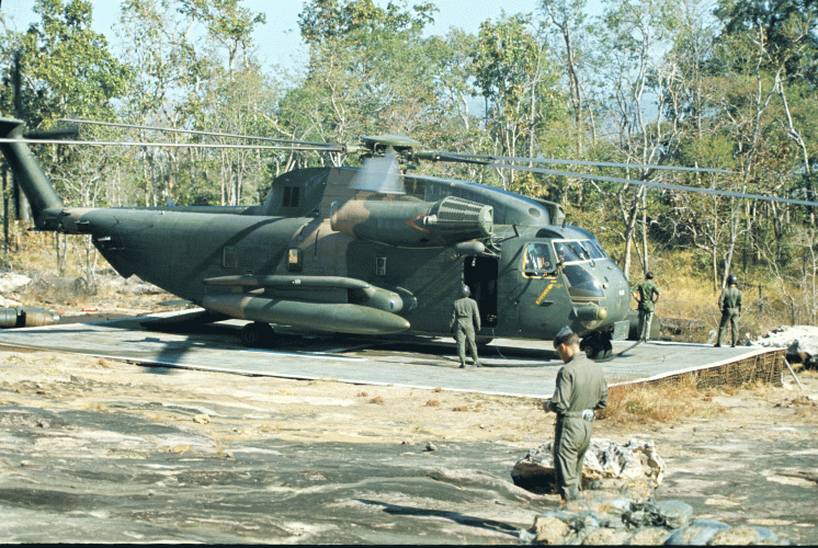
The TACAN was maintained by USAF personnel at UDORN. We knew we had to go to the site to assess its status. The CIA provided a "PORTER" turbo prop STOL aircraft and had a helicopter on call for our ascent to the mountain top to make any necessary repairs. Our first priority was to make a fly-over with the Porter. If it was determined it was Unfriendly then the helicopter would not be needed.

On our team we had an EOD guy to defuse any booby traps, a technician and myself. We made three passes over the site; the last one being at tree-top level. This last pass was a bit dicey as the brits would say. There appeared to be at least 4 Bad-Guys who opened up on the Porter with AK-47's. The Windshield was blown out and that pilot could not get out of there fast enough. Those familiar with the Porter know how slow it moved. After landing in Pakse, we counted the holes in the plane. We stopped our count at 165. We knew we would not be needing the helicopter that day.

After two failed sortee attempts to destroy the Channel 72 site, my commander, Col Bolger, at the 7/13th AF morning staff meetings asked why was it so difficult to take out a stationary target. It was finally destroyed on the 3rd sortee attempt.

I also completed TACAN site surveys at PAPA Site 22 and PAPA Site (??) just west and above the Ho Chi Min Trail. After the closing of Mukdahan, Thailand (across from Savanakhet, Laos), I installed a TRC-35 Comm relay to support the CIA/Sanitized USAF operation at Savanakhet. The Chinese cook there made the best soup and salad lunch I have ever had anywhere. The TRC-35 was a shot to the Army run Phu Mu hill-top comm site above the Mekong river.


WARREN

Communications Engineer/Radar/NAVAIDS/Computers/NKP 66-67(Det 5 - Invert) NKP 68-69(Task Force Alpha) Udorn 69-70-71 Plans/Programs/Communications/Engineering
 
Great information! Thank you for sharing. If the helo was pictured at 105.7995374E; 14.8962039N, then, given the antennas visible in the background, the site looked like a commo station or a radio relay. I couldn't spot a TACAN antenna. Google maps' satellite photo of that site is unfortunately obscured by clouds. It would be interesting to verify what was left from the war time out there.

The file with the list of LS/PS sites mentioned TACAN only at Vientiane (operating on ch 68) but with coarse location. I assume it was installed within the Wattay airports just north of the pin.

We know there were more TACAN stations in Laos in the 1960s apart from LS-85 and LS-61. Finding their locations would contribute to better understanding of challenges and constraints in USAF jets' navigation routes from Thailand to NVN in the 1960s.
Pins are based on locations in the Air America Facilities guide and other online sources which in those days was done by estimating coordinates from a map that is why I estimated 1/2 mile accuracy - some cases more some cases less
 
Last edited:
It has come to my attention in recent years that there are "persons" out there that have been attempting to create false narratives around the LIMA sites of the 1960s. These "persons" post on forums, etc. about sites that were "secret" and never documented. Sometimes these persons claim to have been there, other times they are just posting to corroborate other false posts.

One person has used these false LIMA site stories to bolster his own stolen valor claims. The same person has frequently created fake accounts that post "corroborating" information for his own posts. There are whole multi page threads out there of him having conversations between his fake accounts.

So when it comes to this subject very careful about vetting and verifying information.
 
Could you elaborate the matter a bit more as to what shall be considered a false narration on the LS?
 
Great information! Thank you for sharing. If the helo was pictured at 105.7995374E; 14.8962039N, then, given the antennas visible in the background, the site looked like a commo station or a radio relay. I couldn't spot a TACAN antenna. Google maps' satellite photo of that site is unfortunately obscured by clouds. It would be interesting to verify what was left from the war time out there.

The file with the list of LS/PS sites mentioned TACAN only at Vientiane (operating on ch 68) but with coarse location. I assume it was installed within the Wattay airports just north of the pin.

We know there were more TACAN stations in Laos in the 1960s apart from LS-85 and LS-61. Finding their locations would contribute to better understanding of challenges and constraints in USAF jets' navigation routes from Thailand to NVN in the 1960s.
Another source https://www.cavwv.org/lao-lima-sites.html https://911gfx.nexus.net/Finding_a_Lima_Site.html
The google earth map was derived from the America Facilities Guide and the link above. The AA facilities guide was used for facilities data while the MGRS position was converted to LAT LON and is generally within 1/2 mile in most cases - some more some less. The MGRS conversion did introduce some error. Google Earth will display MGRS but you must enter one point at a time. KML does not support programming MGRS positions.
 
Last edited:
There is a tool in Google Earth under Tools called ruler. You can use it to draw a circle with a radius of 1/2 or 1 mile from the pin to find a lot of the sites. Some were just open fields like soccer fields used by helos or stretches of open road straight enough to land a STOL aircraft. The mountain side STOL strips are probably long since overgrown.
 
In the light of the pdf file, there was no TACAN station at Vientiane. Right?
 
Don't know for sure since same source has Channel 68 there. Air America used a mix of aircraft. I doubt the civilian aircraft would have had a TACAN - maybe only the C-130s and C-123s? The Army didn't use TACANs either relying mainly on VORs and NDBs. Not sure about the Marines who had a big F-4 base at Nam Phong . I am guessing most of the H-34s Air America used were left overs from the Marines. So the primary TACAN user was the Air Force. TACAN information was used to warn aircraft of air strikes so they could avoid the area involved. They were broadcast on guard frequency UHF 243.0 saying avoid the xxx Radial xxx DME from channel XXX for the next xxx Minutes. You didn't need a TACAN to avoid the air strike only a map and a quick estimate.
 

Attachments

  • 2025-05-19_12-05-20.jpg
    2025-05-19_12-05-20.jpg
    224.6 KB · Views: 17
  • 2025-05-19_12-43-02.jpg
    2025-05-19_12-43-02.jpg
    176.6 KB · Views: 19
TACAN was primarily used by the USAF, USN and USMC jets in that time. It was the most reliable and accurate military air navigation system available during the Vietnam War.

I also do not know if Air America aircraft or RVNAF jets were fitted with TACAN.

There are some memoirs of Thud airmen on the web, who mentioned TACAN radials and DME when reporting position.

Which publication did the two pages quoted by you emerge from?
Air America Air Facilities Data Laos
 
Last edited:
Back
Top Bottom