New ash cloud

Grey Havoc

ACCESS: USAP
Senior Member
Joined
9 October 2009
Messages
19,711
Reaction score
10,142
From the BBC:

_52930924_ashcloud.jpg


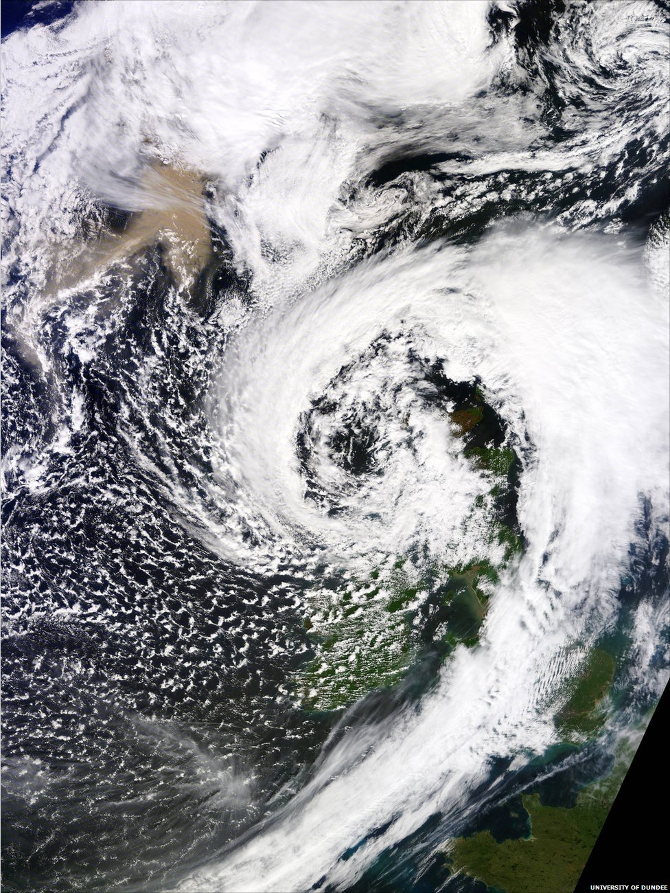
The ash cloud from the Icelandic volcanic eruption is captured on a satellite image as it approached the UK.

The pink-coloured drifiting ash, in the top left of the picture, was taken by Nasa's Terra satellite on Monday afternoon and has been published by Dundee University's Satellite Receiving Station.

The white cloud sitting over north west Scotland is a low pressure system which has brought high winds and heavy rain to many areas of Britain.

The winds are coming from a north-westerly direction, blowing anti-clockwise round the low pressure system, drawing the ash plume from the volcano towards the northern half of Britain.

http://www.bbc.co.uk/news/uk-scotland-13519331
 
IIRC, North German air-traffic control have stuck to letter of recommendations and closed several airports today. Other areas have taken a more pragmatic approach, perhaps re-routing around / under the cloud, or at least through its penumbra...

IIRC, Central / Southern UK may get a bad dose on Friday, riding in on tail of some Atlantic cyclonic weather but, as the volcano activity is currently in decline, that may be the last fling of this eruption.

Of course, it could yet go 'postal', melt a lot more of the over-lying ice-cap, interact with the water, generate the 'wrong sort of ash' ie micro-fine glass shards, and dump across EU...

Hey, it beats the usual outage due to French air-traffic controllers taking their annual strike !!
 
Once again:

Fortunately, no giant ash clouds with this one.

Unlike the Eyjafjallajökull eruption in 2010, which grounded 900,000 flights, the met office does not expect huge clouds of ash or a need for mass evacuations.

Instead, they expect dramatic lava fountains.
 

Similar threads

Back
Top Bottom