- Joined
- 11 February 2010
- Messages
- 1,445
- Reaction score
- 1,940
I wonder why i cant find this sooner.

 www.cambridgepixel.com
@SOC can make a great use of this tool.
Basically the tool allows you to plot a realistic radar coverage based on DEM (Digital Elevation Model) a.k.a Digital terrain model like SRTM or maybe others in the Pro version. This allows a good insight on placement of radar site and what's limiting its coverage. The best thing of all.. there is FREE version. The only complaint is that it needs internet as it will need to download the SRTM data of your selected site, i see this can be of a considerable time.
It is however does not model radar range. But still extremely useful as typical Radar would have Instrumented range ("programmed" range where radar consider that it has "enough" signal to declare a contact).
These are some example i made.
Hymeim Airbase S-400 Radar Coverage

Syrian (But Russian controlled) S-300PMU-2 Site in Masyaf

Notice that despite being located on mountain/hill the S-300PMU-2 have rather inconvenient coverage and NO coverage at all in Syrian Capital for anything flying NOE and 3000 m.
Coverage of apparently the 2nd Russian S-400 Site at Tartus.

The GUI is pretty straightforward, one only need to insert the site location, easily found via googleearth. The desired coverage circle, the radar elevation coverage (in degrees this is for typical early warning radar can reach 30-40 deg). Target altitudes can then be defined by colors and array in "target heights" form.

Some other example. The Coverage of one Indonesian Radar Unit (SATRAD- Satuan Radar) 243 Timika.

It has good Southern coverage but Not in the North due to Mountain range.

Radar Coverage Tool (Free Download)
Select the best location for a radar. See the expected radar coverage and potential blind spots at the chosen location and height with the local terrain.
@SOC can make a great use of this tool.
Basically the tool allows you to plot a realistic radar coverage based on DEM (Digital Elevation Model) a.k.a Digital terrain model like SRTM or maybe others in the Pro version. This allows a good insight on placement of radar site and what's limiting its coverage. The best thing of all.. there is FREE version. The only complaint is that it needs internet as it will need to download the SRTM data of your selected site, i see this can be of a considerable time.
It is however does not model radar range. But still extremely useful as typical Radar would have Instrumented range ("programmed" range where radar consider that it has "enough" signal to declare a contact).
These are some example i made.
Hymeim Airbase S-400 Radar Coverage
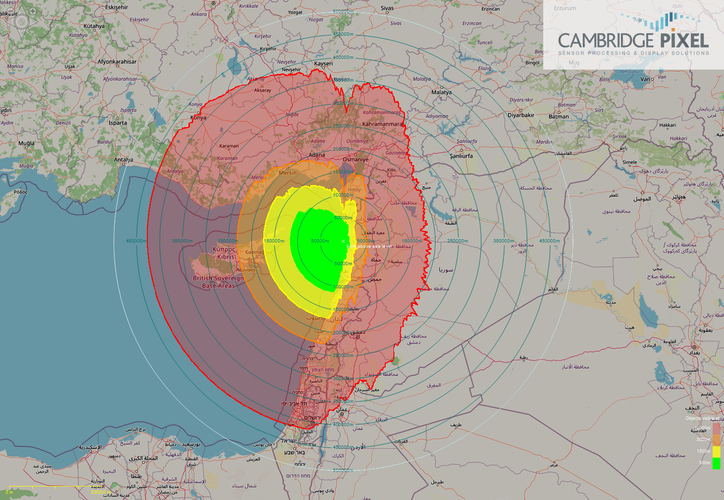
Syrian (But Russian controlled) S-300PMU-2 Site in Masyaf
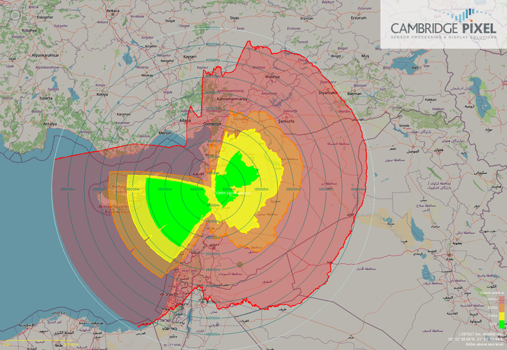
Notice that despite being located on mountain/hill the S-300PMU-2 have rather inconvenient coverage and NO coverage at all in Syrian Capital for anything flying NOE and 3000 m.
Coverage of apparently the 2nd Russian S-400 Site at Tartus.
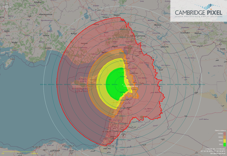
The GUI is pretty straightforward, one only need to insert the site location, easily found via googleearth. The desired coverage circle, the radar elevation coverage (in degrees this is for typical early warning radar can reach 30-40 deg). Target altitudes can then be defined by colors and array in "target heights" form.
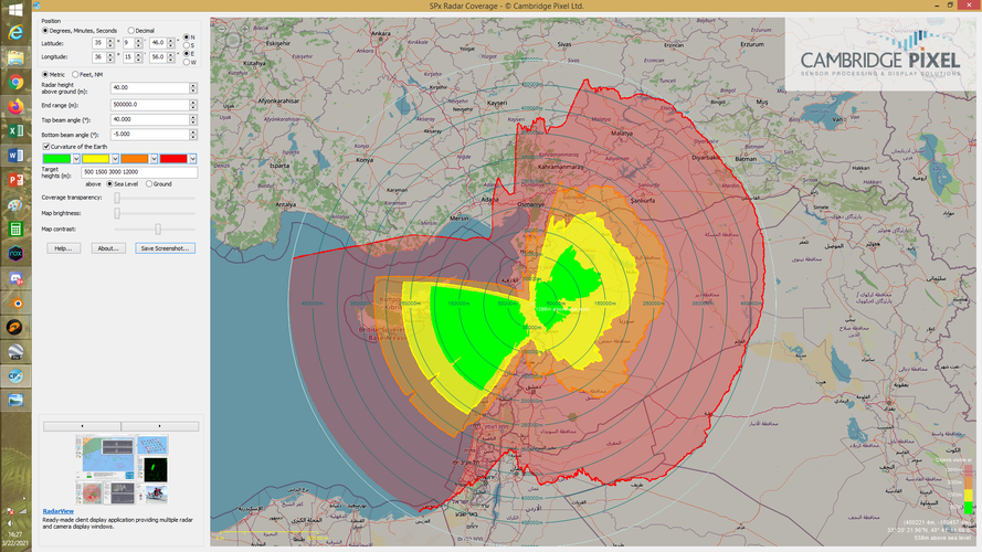
Some other example. The Coverage of one Indonesian Radar Unit (SATRAD- Satuan Radar) 243 Timika.
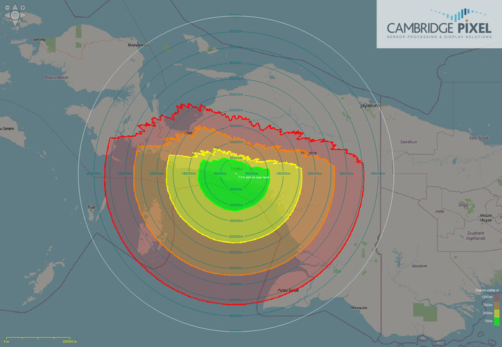
It has good Southern coverage but Not in the North due to Mountain range.
Last edited:
