A few days ago China launched Gaofen-13.

 spacenews.com
View: https://twitter.com/i/web/status/1315453621241180160
That wouldn't be news worthy if it wasn't for the fact it was launched to a GEO orbit, some 36 km up.
Officially, it's part of the CHEOS program, civilian crop monitoring, land surveying, urban planning, agriculture and disaster relief.
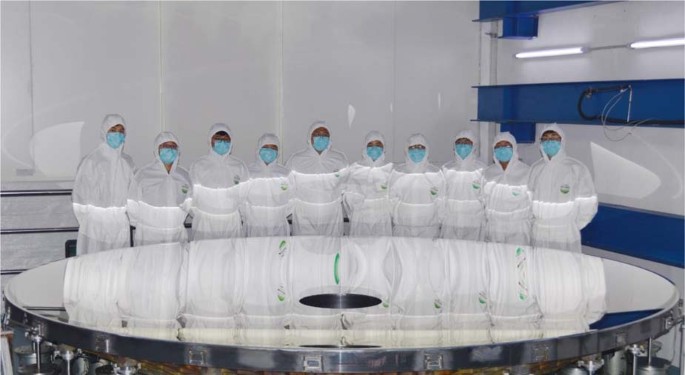
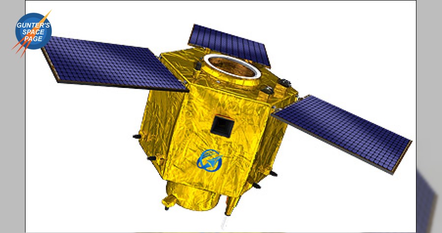
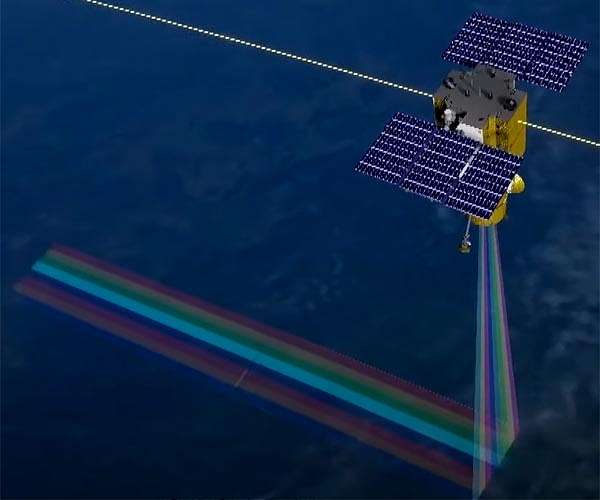
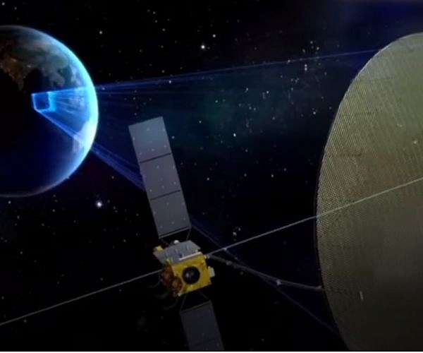
And the visual depiction of the satellite released makes it clear it has a rather huge mirror.
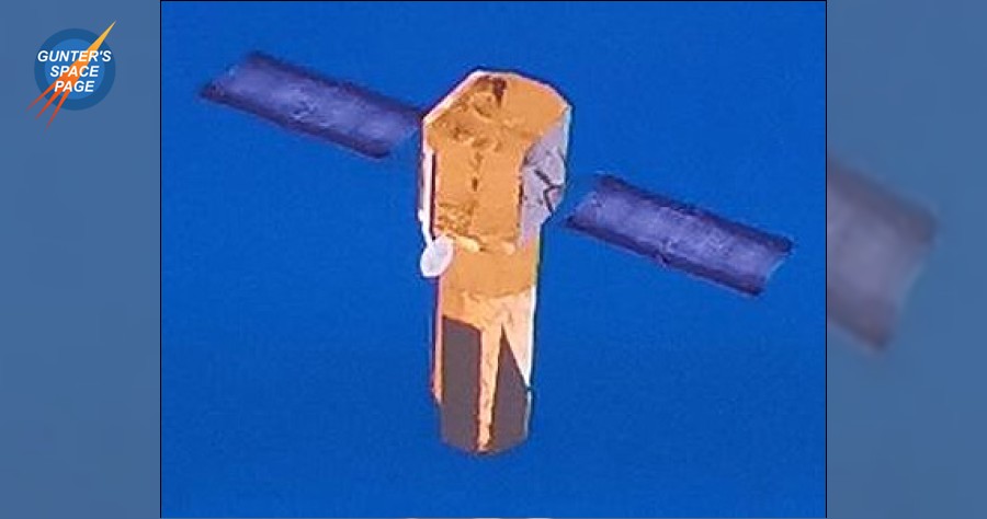
5 Years ago China launched Gaofen-4, a similar but smaller GEO optical satellite. Basically a constantly staring sensor.
But being smaller, its resolution was touted as 50 m. Which is actually nothing to be sneezed at either.
But now, various estimates of the mirror size of this Geofen-13 seem to go from "at least 1.5" to "anywhere between 1.7 and 2 m".
If the 1.7m aperture would be correct, that'd point out to ground resolution of 15 meters or better.
To my knowledge, while other space agencies did talk about GEO high res observation sats, China is the only one which is actually
launching them. And seems to be improving resolution to quite useful levels.
Implications of satellites with such capabilities may be significant.
China launches Gaofen-13 observation satellite towards geostationary orbit
Chinese Earth observation Gaofen-13 is on its way to a geostationary orbit after successful launch on a Long March 3B from Xichang Oct. 11.
spacenews.com
View: https://twitter.com/i/web/status/1315453621241180160
That wouldn't be news worthy if it wasn't for the fact it was launched to a GEO orbit, some 36 km up.
Officially, it's part of the CHEOS program, civilian crop monitoring, land surveying, urban planning, agriculture and disaster relief.
And the visual depiction of the satellite released makes it clear it has a rather huge mirror.
5 Years ago China launched Gaofen-4, a similar but smaller GEO optical satellite. Basically a constantly staring sensor.
But being smaller, its resolution was touted as 50 m. Which is actually nothing to be sneezed at either.
But now, various estimates of the mirror size of this Geofen-13 seem to go from "at least 1.5" to "anywhere between 1.7 and 2 m".
If the 1.7m aperture would be correct, that'd point out to ground resolution of 15 meters or better.
To my knowledge, while other space agencies did talk about GEO high res observation sats, China is the only one which is actually
launching them. And seems to be improving resolution to quite useful levels.
Implications of satellites with such capabilities may be significant.


")