Dumb Question... What is this? (odd mockup at Lockheed Ft Worth)

ohpossum

ACCESS: Restricted
Joined
10 September 2008
Messages
15
Reaction score
2
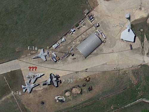
Wondering if there was any new imaging of the A-12 mockup I was looking at the area in google earth. South of the A-12 and CALF testbed, inside the factory area, is an odd mockup of the front half of an airframe. It seems to be enclosed, but open to the sky. Bigger than the F-16 parked just to the south. I'm just wondering what this was used for.


Mods, feel free to delete this if you think the forum is turning too much into "ZOMG! I just found the super-secret blahblah sitting in a field in Google Earth"


7428786642_2e8a8f4c99_z.jpg


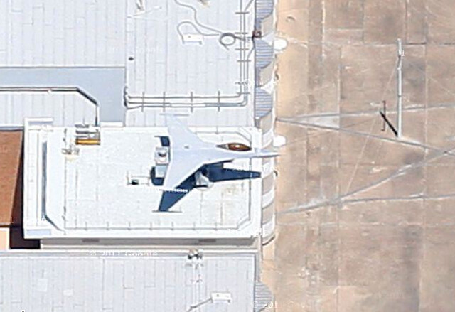
32º46'33" N 97º26'44" W


Thanks,
Brian


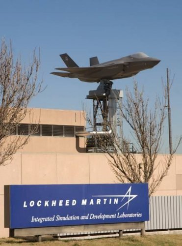
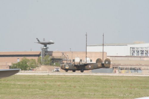
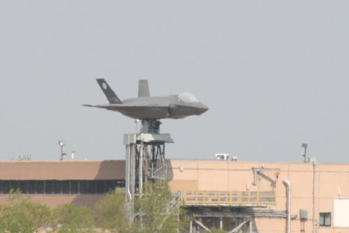
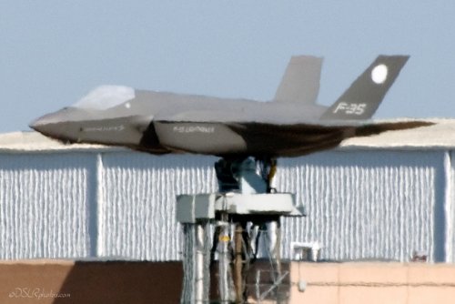
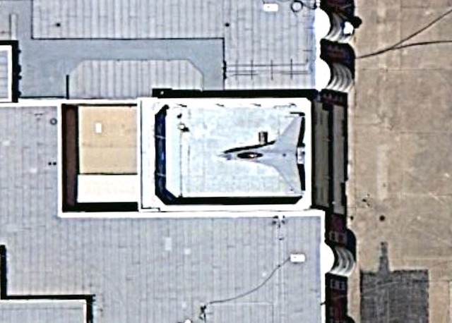
EDIT: Yep, I'm dumb..Its just a mockup of the front half of an F-16 over an entrance. The shadows in Google Earth make it look as if its inside, when its really on the roof..


7428912514_694d9077ae_z.jpg


However, it is most awesome air conditioner condenser cover in the world..


Mods, please feel free to delete this. Sorry for wasting everyone's time.


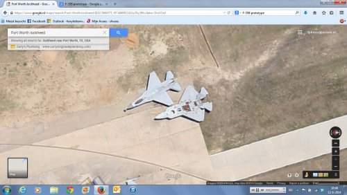
FWIW, the online google maps imagery is the newest. The A-12 mockup has been wrapped up really well and they've wrapped up all its appendages that had previously been lying on the ground. It also has what looks like a T-6 with chopped wings there to keep it company.
 
The VERY newest (4/4/12) GE images show something interesting near the A-12. The A-12 is also no longer covered.
 
Am I crazy, or did that F-16 mockup get turned 180 degrees between the two pictures?
 
So, what's the bird next to the A-12?
F-22ish...?

The F-16 mockup seems to lie on an elevator platform. If you look at the 2009 picture, it is clearly recessed down into the building.
Just strange...
 
A few 100's meters further you can see a full model of a F-35 on top of a building.
Coordinates are 32.782808, -97.446636

In my version of google maps I can only see a wrapped up version.
In google maps editor(which most people wont have) I can see the wrapping in bad condition.
In some other thread someone went looking for the A-12 and only could find the other wing parts, but I can't remember who...

Cheers,

Rob
 
BAROBA said:
A few 100's meters further you can see a full model of a F-35 on top of a building.
Coordinates are 32.782808, -97.446636

In some other thread someone went looking for the A-12 and only could find the other wing parts, but I can't remember who...

Cheers,

Rob

That was me. The centerbody was still at what was going to be the Alliance Museum. Sitting next to the A-12 mockup is just an old F-16 in a dark W. Europe camo. Shadows are playing tricks on you. The other odd piece is the Lockheed X-32 LSPM which was used at Dryden for the ASTOVL/JAST powered model tests back in 1994ish.
 
oh, and those partial mock-ups of the F-16 and F-35 on top of the buildings do rotate and are used for some avionics testing.
 

Attachments

  • Open Air System Integration Station (OASIS).jpg
    Open Air System Integration Station (OASIS).jpg
    86.9 KB · Views: 319
  • b-24-f-35-107w-1.jpg
    b-24-f-35-107w-1.jpg
    75.6 KB · Views: 307
  • f-35-107w-2.jpg
    f-35-107w-2.jpg
    60.1 KB · Views: 35
  • 20110416-nasfw-013.jpg
    20110416-nasfw-013.jpg
    290.6 KB · Views: 27
Two members have shared these Google satellite images in a Facebook group, and they raised a few eyebrows.

The aircraft between the two F-16s looks a lot like a CALF prototype at first glance, but then it doesn't have canards and has horizontal tails instead.

Also the camoed F-35's air intakes seem to have a very weird shape.

Any thoughts?
 

Attachments

  • 10463894_10203907120058350_4850583496963448510_n.jpg
    10463894_10203907120058350_4850583496963448510_n.jpg
    98.6 KB · Views: 93
  • 10371337_10152081568117172_1333043175929658996_o.jpg
    10371337_10152081568117172_1333043175929658996_o.jpg
    109.9 KB · Views: 101
a CALF prototype at first glance, but then it doesn't have canards and has horizontal tails instead.


I thought they got swapped round during development? The fittings for the canards wouldn't show up in the satellite image.


RP1
 
Fair enough. This photo shows the same alternate configuration as seen in the satellite photo:
 

Attachments

  • 10352202_10152566179790802_2300880950023784715_n.jpg
    10352202_10152566179790802_2300880950023784715_n.jpg
    37.1 KB · Views: 45

Similar threads

Back
Top Bottom